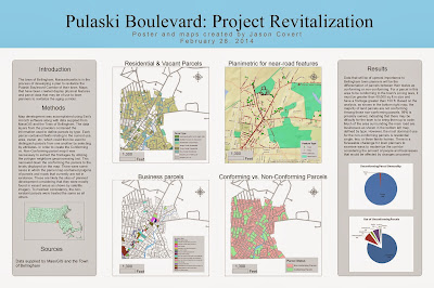
Pulaski Boulevard is the subject of the latest revitalization project proposed by the Town of Bellingham, Massachusetts. Pulaski Boulevard is a main street, lined with small businesses, that intersects a corridor that is riddled with aging buildings and nonconforming land parcels. It will be necessary for town planners to identify which parcels do not comply with the zoning laws and to determine who will be effected by any changes. For this task, we have GIS.
Above is a presentation in poster format designed to assist town planners in moving forward with the revitalization of Pulaski Boulevard. In the maps on the left, residential parcels and businesses were identified by type. The map in to top right shows near-road features that may be of importance to town planners like street trees, telephone poles, and sidewalks. In the bottom right, parcels were distinguished based on their status as conforming or nonconforming to Bellingham's current zoning laws. The criteria used to identify the conforming parcels was a size of over 40,000 sq ft and a frontage of over 150 ft. As is clearly shown, the majority of land parcels are nonconforming.
No comments:
Post a Comment